 Pine Plains is blessed with an abundance of natural beauty and resources for our recreational enjoyment.
Of course, early European settlers and town folks did not typically look at their surroundings the way we do today. To them, these surroundings provided materials which they needed for everyday life, or which could be used for economic gain.
Let us take a closer look at some of Pine Plains' natural habitats and see what affect our uses of the resources they supplied had, and continue to have, on the development of the town and on the environment.
Mountains and Hills
The age-old question: is it a hill or a mountain?
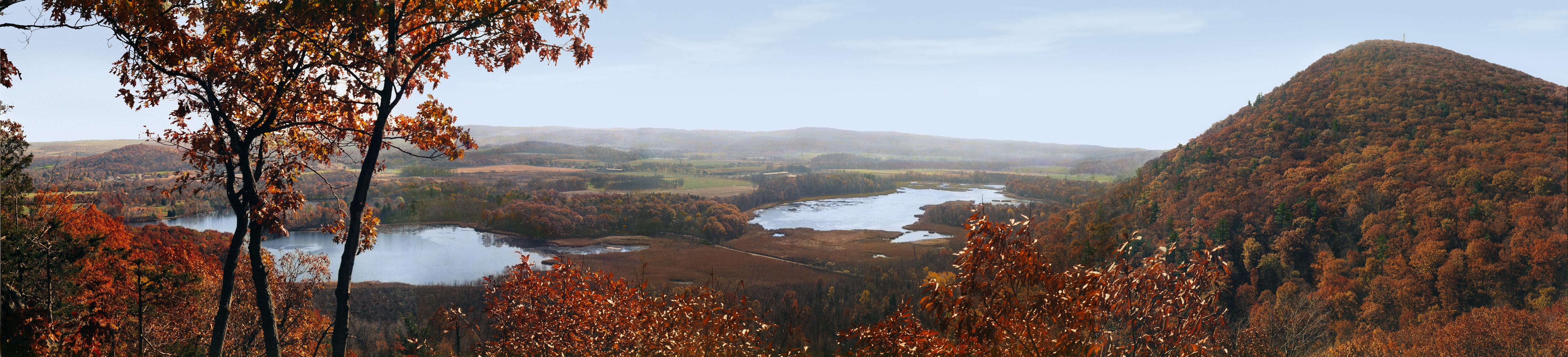
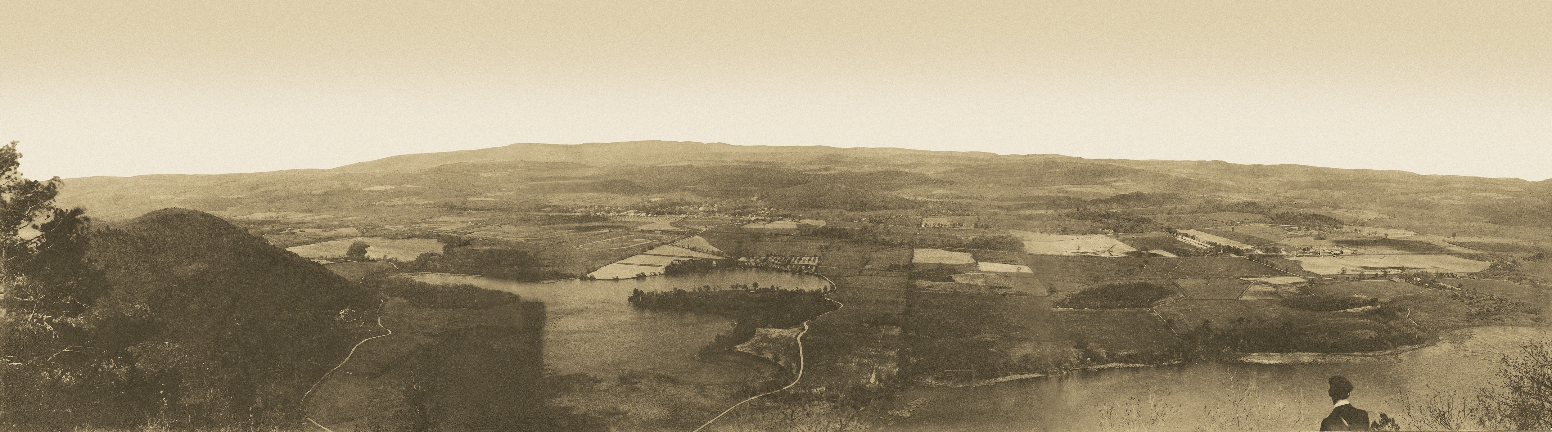
Although the U.S. Geological Survey today makes no official differentiation between a hill and a mountain, a mountain is generally steeper than a hill, and anything above 1,000 feet used to be considered a mountain (although visitors from the western United States might beg to differ). Stissing Mountain is 1,403 feet (428 m) above sea level. While not the highest point in Dutchess County, it does have the advantage of a fire tower at its summit which commands an outstanding view of the surrounding region, and on a clear day one can see Albany.
It is also unique from a geologist's standpoint. Stissing Mountain is a block of 1.1 billion year old Precambrian gneiss on top of younger shale and sandstone, and located quite a few miles from any other Precambrian bedrock.
A "high Stony Hill good for little"
While the name Stissing is most certainly of Native American origin, we don't know precisely its etymology. Earlier forms of the word are Tishasink, Teesink, and Stissink. In his book, Aboriginal Place Names of New York, William M. Beauchamp says that its possible origin is the Algonkian word tahshin, meaning "he raises himself". There is a legend that the mountain was named for an Indian chief who lived in the notch between Stissing Mountain and Little Stissing, its neighbor to the immediate north.
The Great Nine Partners Patent survey map, which is of the patent to the immediate south of the Little Nine, shows a rough outline of the mountain (since it straddles the boundaries of the two patents) and here it is called Stissink Mountain. This map was originally drawn in 1734 by surveyor Richard Edsall, so this may be the earliest written record we have of the name of this mountain.
At the time of the Little Nine Partners Patent survey in 1743, surveyor Charles Clinton, apparently unaware of any name for the mountain, writes in his journal that he has come upon a "high Stony Hill good for little, the land to this is Indifferent Good". He then notes that the east side of the hill is "poor pitch pine land." Evidently, he and his corps of surveyors were not impressed by what they found here.
One thing that Stissing Mountain and Little Stissing provided the area, together with Winchell Mountain to the east, was isolation. A lack of navigable rivers and roads were also contributing factors. Even so, European settlers began trickling into the area by the mid-1700s. It was this isolation that helped protect Pine Plains from being invaded by Tories during the American Revolution (see "Pine Plains Went to War" page).
However, because of its centralized location, this area became the seat of government for North East Precinct when it was organized in 1746 (becoming the town of North East in 1788). But that isolation proved to be a hindrance to governing and eventually the area west of the mountain split off, forming the town of Milan in 1818. Then Pine Plains itself split off from North East and was organized in 1823.
One could make the argument that this isolation, which still exists to some extent today, also had a hand in shaping Pine Plains' character. Fiercely independent, yet in many ways ahead of its time, Pine Plains defied expectations for a rural town throughout much of its history (see "Fun Facts About Pine Plains" page).
"the pine plains"
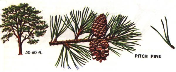 The area was known as "the pine plains" for many years before it became the official name of the town in 1823, no doubt from those pitch pines which Charles Clinton took note of in 1743. As it happens, pitch pine is useful for a good many things, one being in the production of charcoal. By the late 1700s, charcoal was being used to fuel the furnaces at the Harris Scythe Works in Hammertown (see "Industries Along the Shekomeko" page).
The charcoal industry was not ecological. A single blast furnace could consume an acre of mature hardwood forest, converted into charcoal, in a day. Once a forest was stripped of timber, it took about 20 years for regrowth sufficient to allow another clearing.
While logging for the charcoal industry in the late-18th to mid-19th century played a role in clearing the old-growth pine forests from Stissing Mountain and from the glacial outwash plain spreading east from its foothills (how much of a role is debated), the trees also provided building materials for people's homes and fuel for them to heat and cook with. Wood, in fact, was used for almost everything. Once cleared, this flat land made ideal farmland.
The trees on Stissing Mountain have grown back, but the upland forests today are comprised mostly of deciduous species such as black birch and oak. Some old-growth pine stands that were inaccessible to logging may, as speculated by Hudsonia, still remain in isolated areas on Stissing Mountain.
New York State acquired 590 acres of the mountain to form Stissing Mountain Multiple Use Area, which covers land in the towns of Pine Plains, Milan, and Stanford. According to the "New York State Forests" web page, multiple use areas are:
"Funded by the park and recreation land acquisition bond acts of 1960 and 1962 to provide opportunities for outdoor recreation, including public camping, fishing, hunting, boating, winter sports. Wherever possible, the multiple-use-areas should also serve multiple purposes involving the conservation and development of natural resources, including the preservation of scenic areas, watershed protection, forestry and reforestation."
Meanwhile, beginning in 1958 the Nature Conservancy has acquired 507 acres of Stissing Mountain and Thompson Pond, forming Thompson Pond Preserve (see below). The first 180 acres of this acquisition, encompassing Thompson Pond, was purchased from the Briarcliff Farm holdings of George W. Brown for $20,000 and was one of the Nature Conservancy's first projects.
The New York State Department of Environmental Conservation has also designated Stissing and Little Stissing Mountains, together with the Wappinger Creek Valley, part of a Significant Biodiversity Area called the Stissing Mountain Wetlands Complex.
The hike up to the fire tower is a very popular recreational activity today, but even recreational activities can be harmful to the environment if not done properly. To lessen their impact on this wonderful resource, people are urged to stay on trails and take out what they bring in. Also, ongoing maintenance of trails is necessary to curb erosion.
Mill Hill
This landmark rising up from the hamlet of Pine Plains at one time had a limestone quarry called Thomas' Quarry on its eastern side. The limestone was mined to build walls and foundations, particularly for the factories in the nearby hamlet of Hammertown. The 1867 Beers Atlas map of Pine Plains shows a few other stone quarries around the town as well.
The first water works in the town was installed in 1895, with a wooden water tank on the west side of Mill Hill. The digging of the trenches for the pipes was done by Italian immigrants, whose singing of Italian songs in the evenings entertained the locals, most of whom had never before met anyone from Italy or even of Italian heritage. In 1906, in order to reduce the cost of pumping water from wells up the hill to the tank, the primary water source was changed from the wells to a spring on Stissing Mountain, which was over 23 feet higher than the water tank on Mill Hill and could thereby make use of gravity to fill the tank, with the wells used to supplement the spring during dry periods.
In the 1880s, it was proposed that Mill Hill be used for a toboggan slide. These were apparently all the rage at the time, but it doesn't appear that this was ever done.
Sources and Suggested Further Reading:
History of the Little Nine Partners, by Isaac Huntting, Chas. Walsh & Co., Amenia, NY, 1897
Our Unique Natural Heritage: "Stissing Mountain Revisited", a LNPHS publication, 1969
Our Unique Natural Heritage: "The Felix M. Warburg Memorial Hall", a LNPHS publication
American Museum of Natural History: "Felix M. Warburg Hall of New York State Environment"
The New York State Dept. of Environmental Conservation: "Stissing Mountain Multiple Use Area"
The New York State Dept. of Environmental Conservation: "Stissing Mountain Critical Environmental Area"
"Significant Habitats in the Town of Pine Plains", a report by Hudsonia
"Dutchess County Wetlands Complex"
New York State Museum: Aboriginal Place Names of New York, by William M. Beauchamp, S.T.D., New York State Education Department, Albany, 1907
The Pine Plains Register, The Pine Plains Herald, and The Register-Herald

Wetlands
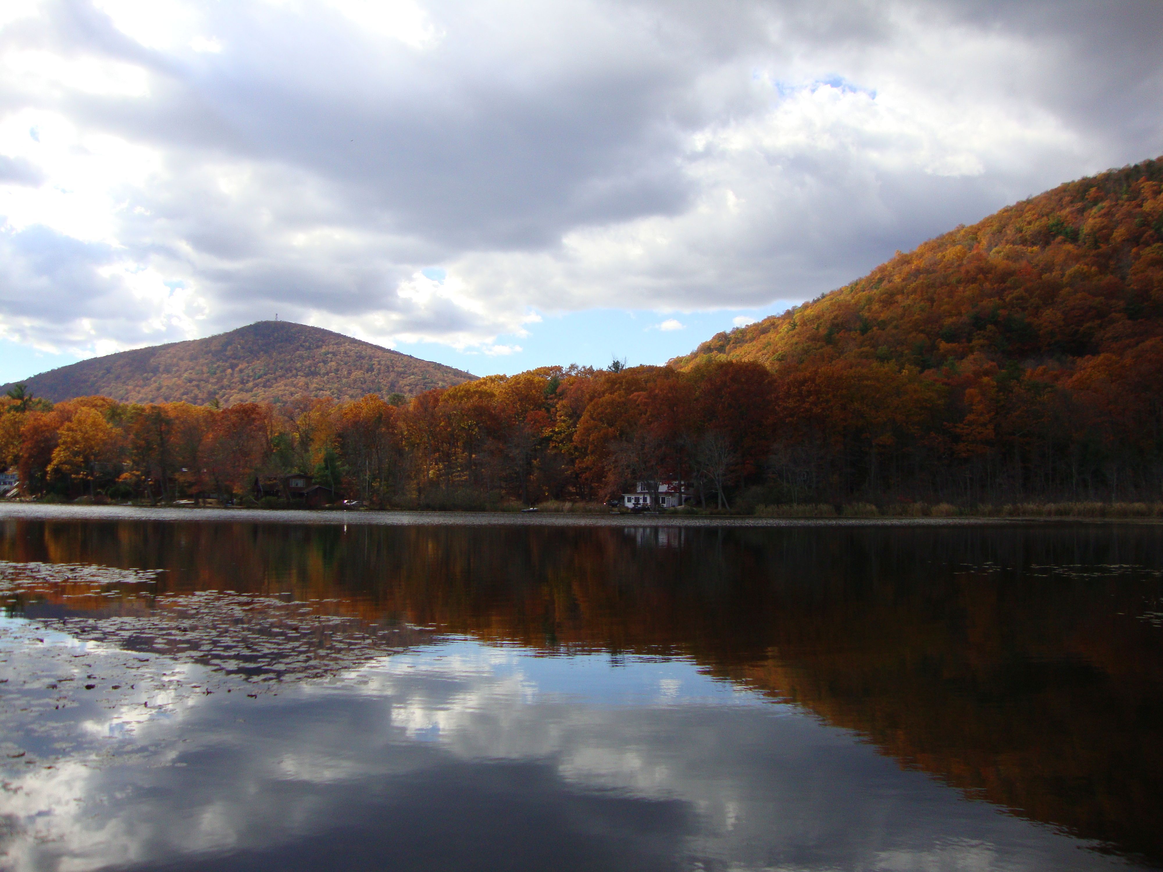
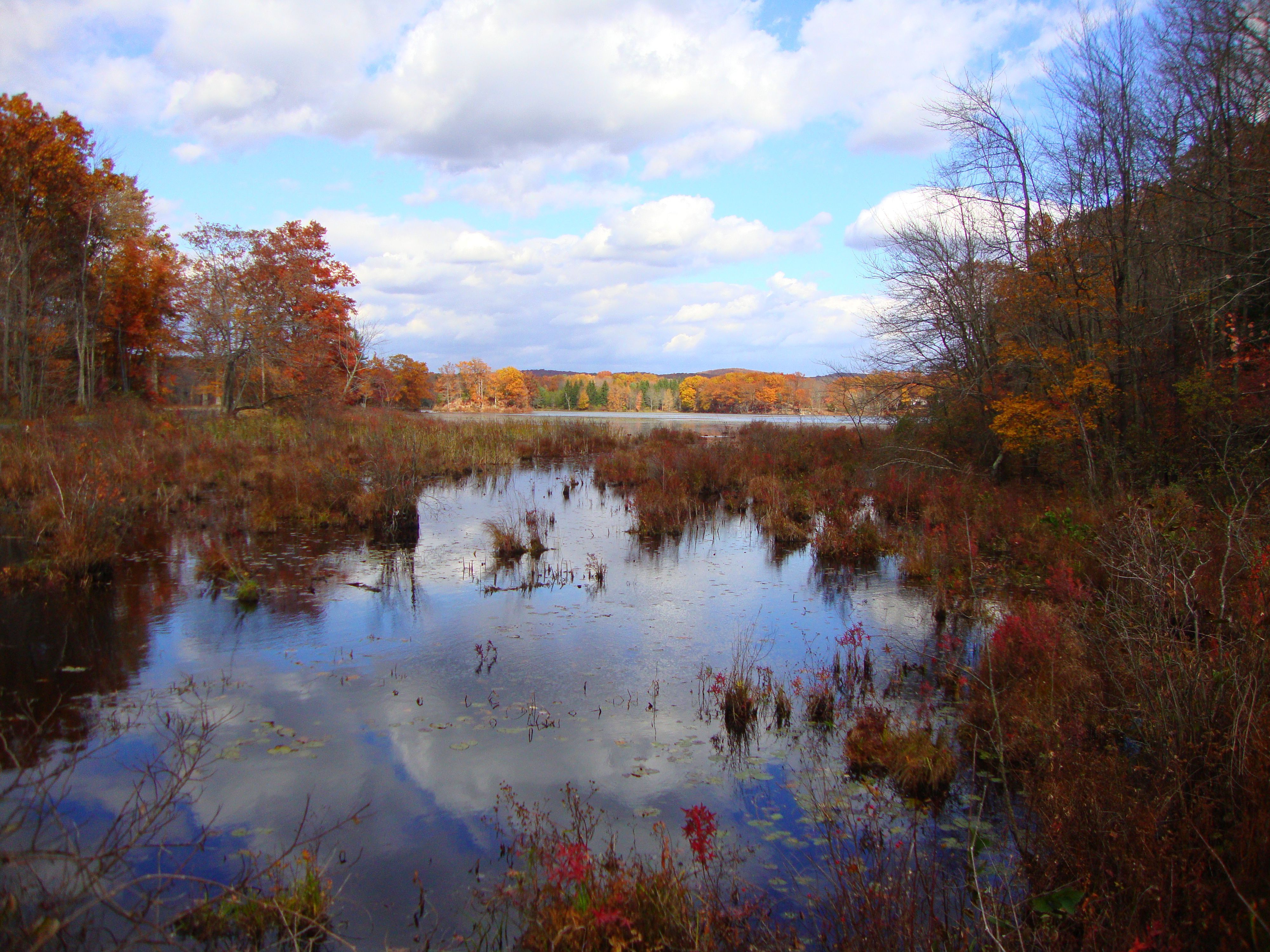
About 15,000 yrs. ago at the end of the Pleistocene epoch, the ice sheet covering this entire area began to melt. Huge blocks of ice became isolated and buried in glacial outwash from the higher elevations. When the ice blocks melted, they left behind depressions that filled with water, forming three contiguous kettle-hole ponds, from north to south: Mud Pond (Twin Island Lake), Stissing Lake, and Thompson Pond. It should be noted that these lakes were not separated by roadway until around 1900.
All three are unique wetlands called circumneutral bog lakes. Bogs form as kettle-hole ponds age and fill in. Most are poorly drained wetlands lacking in biodiversity due to water that is too acidic and cool for plant decomposition needed to put nutrients back in the water. A circumneutral bog lake is fed by rich, mineral springs of neutral to alkaline water which can support a wider variety of plants and animals, however areas of acidic bog also occur.
Thompson Pond
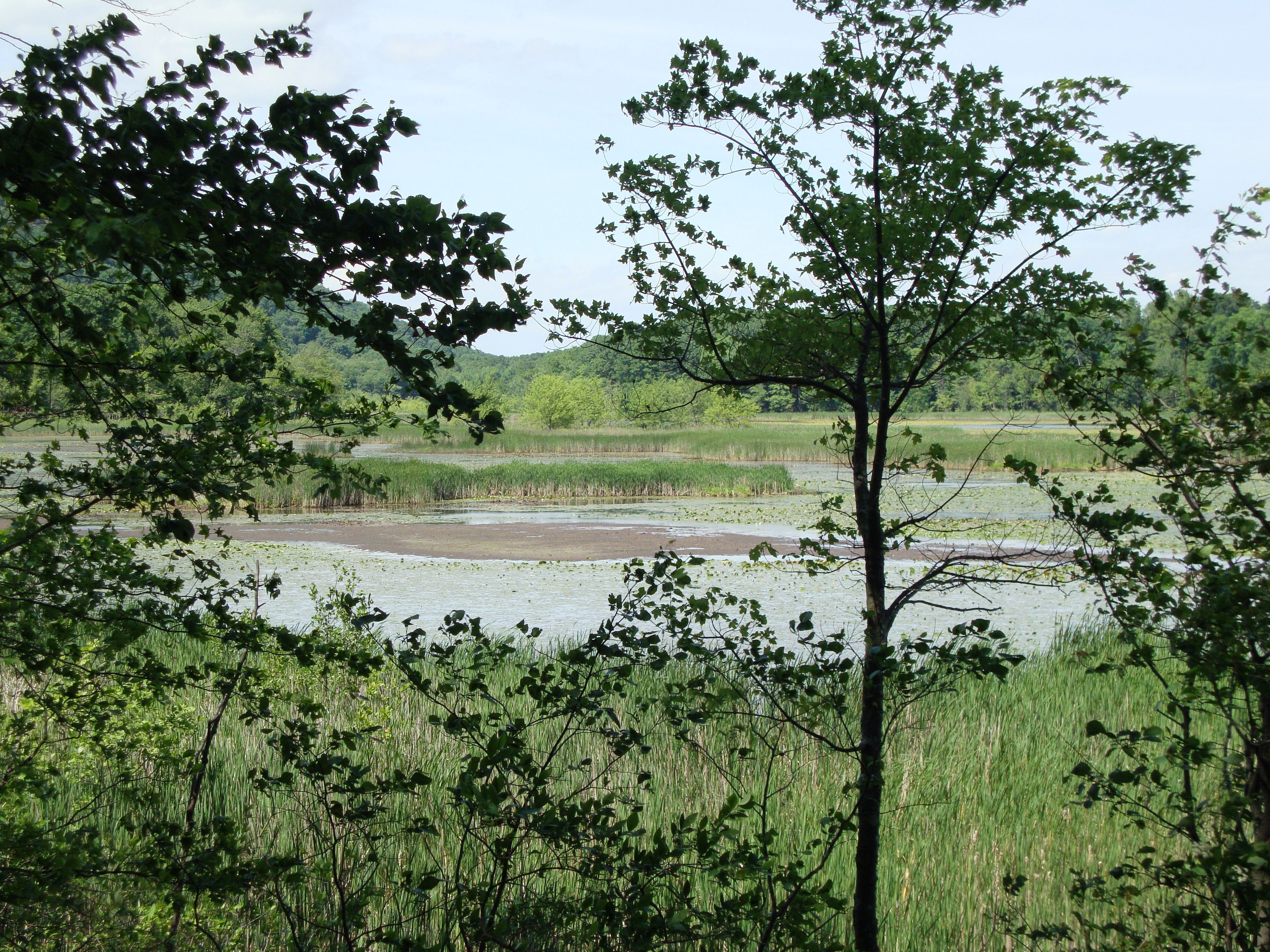
Thompson Pond at its center is open pond wetland with marsh, bog, and swamp wetlands along its fringes. Its outlet is Wappinger Creek, the largest tributary of the Hudson River. In his surveyor's journal in 1743, Charles Clinton mentions encountering a swamp "exceedingly Briarly" at the foot of Stissing Mountain, before crossing "Whapings Creek which runs southerly". This was no doubt Thompson Pond.

Native Americans in the area perhaps found Thompson Pond a source of grasses for making baskets and mats, and herbs for making medicines, and they probably hunted, fished, and trapped here. Part of Lot 28 of the Little Nine Partners Patent, the pond was named for Amos Thompson who settled here in 1746, and while a descendant of his was living in the vicinity in the mid-1800s, it does not appear anyone else ever settled along its shores. Also, unlike Stissing Lake and Mud Pond, Thompson Pond was not fished extensively or used for harvesting ice in winter in the 19th and early 20th centuries, which has allowed it to remain somewhat pristine.
Thompson Pond was designated a National Natural Landmark in 1973. It is home to several rare plants, the threatened northern cricket frog, and the endangered bog turtle, and is a stopover for birds on the migratory flyway.
The walk around Thompson Pond is a popular family activity. Again, people are encouraged to practice responsible hiking in order to protect the environment.
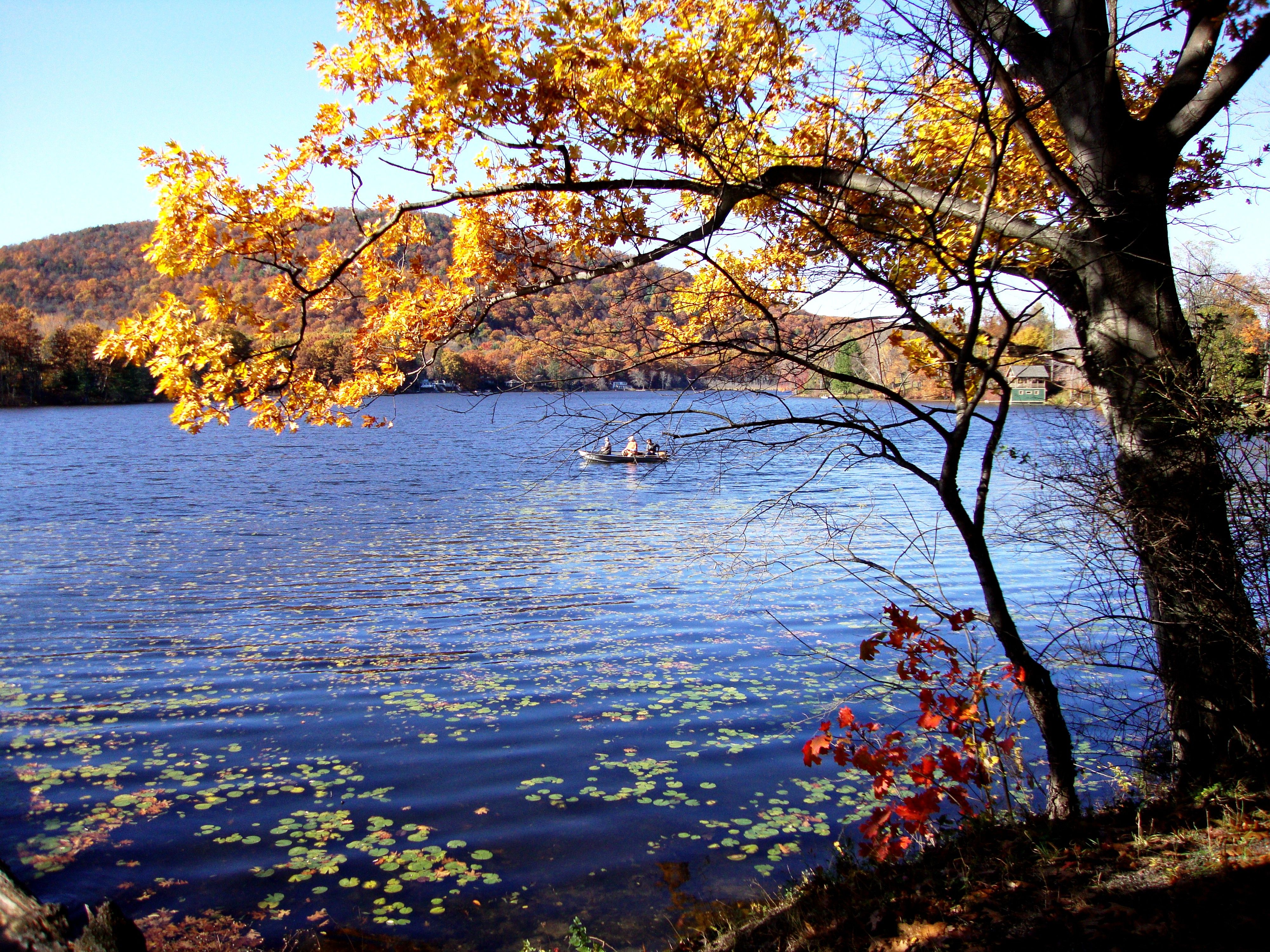
Stissing Lake and Mud Pond (Twin Island Lake)
Stissing Lake was originally called Hoysradt's Pond after Hendrich Hoysradt who was the first recorded owner; it remained in the Hoystradt family for the first 50 years of the 19th century. It has a maximum depth of 25 feet and covers over 70 acres with 2 miles of shoreline. Mud Pond covers about 60 acres. Both shorelines have had moderate settlement.
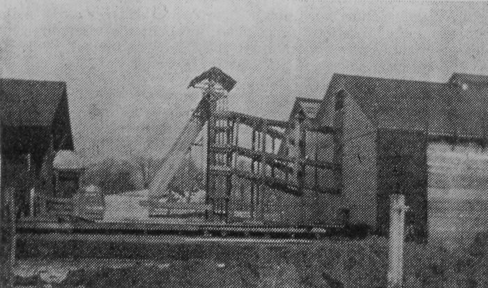
In the days before modern refrigeration, ice was harvested from Stissing Lake and Mud Pond in winter and stored in ice houses in the community. Many farmers had ice houses and they were also located at each of the creameries (places where the local farmers could sell their milk and residents could buy dairy products). Halcyon Lake (see below) was also harvested for ice in winter.
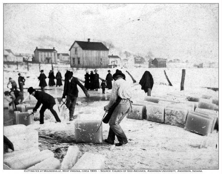
During the railroad era of the late 1800s and early 1900s, these creameries were owned by milk companies and each of the railroad stations had one. In 1902, Borden's Condensed Milk Co. purchased the creamery at the P&E Railroad Station (which would soon merge with the Central New England RR). Ice was also shipped from Pine Plains to the ice houses of the Central New England RR in Maybrook for use in ice refrigeration cars.
 The commencement of the ice harvesting season was big news in the local paper. Here is an announcement from New Year's Day, 1920 in the Pine Plains Register (see inset).
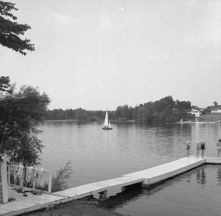
With the advent of the railroads, the lakes became a popular tourist destination for people from New York City. For many years there was a boys and girls summer camp here, Stissing Lake Camps. Today there is swimming, fishing and boating in summer and ice fishing and skating in winter. Stissing Lake has largemouth bass, yellow perch, and bluegills.
In 1991, Mud Pond made history by becoming the first lake in New York State to be stocked with grass-eating carp (899 of them) to help control the aquatic weed problem. The long-term affects of these carp on the ecosystem of a circumneutral bog lake is unknown.
Halcyon Lake (Buttermilk Pond)
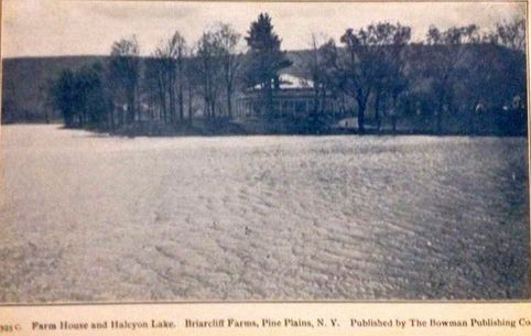
On maps, this body of water about 2 miles south of the hamlet of Pine Plains is called Halcyon Lake, but apparently it was called Buttermilk Pond by locals much earlier. The "buttermilk" refers to the white marl, a calcium carbonate-rich mud found at the bottom of the pond which gives the water the appearance of diluted milk. It is one of only two marl lakes in Dutchess County.
This sediment was mined by farmers in the 19th and 20th centuries because it was valued as a fertilizer for lime-deficient soils. Since leather tanners often used calcium carbonate as a depilatory to remove hair from animal hides, it is possible that some marl from Halcyon Lake was used for that purpose in the Hammertown tannery.
It does not appear that the marl in Halcyon Lake was ever mined on a commercial scale. There was some consideration of using it for making cement (another product of marl). The Pine Plains Register in 1890 reported that a Mr. Donaldson of Barrytown was looking at Halcyon Lake as a possible site for a cement plant, with a branch track of the N.D. & C. Railroad able to be laid to this location. For whatever reason (thankfully) this never happened. However, according to the U.S. Fish and Wildlife Service, the mining of Halcyon Lake has still done long-term ecological damage and the lake has been invaded by non-native plants.
In 1919 The Register ran a story about a drainage operation being undertaken at Halcyon Lake by Oakleigh Thorne, the new owner of Briarcliff Farms, in order to unclog the drainage ditch and enable them to get at the marl. Thorne was using dynamite to blast a larger and deeper ditch: when done, the ditch would be 8 feet wide and 2½ - 4 feet deep, and the level of Halcyon Lake would be lowered about 4 feet, exposing the marl.
Apparently, Halcyon Lake was once about 84 acres with swamps on the west and north, but as of 1919, through the use of ditching to drain the swamps and the cutting down of trees, it had been reduced to 30 acres. This was done to create more pasture land. There was also talk at this time of deepening Wappinger Creek (called the "Big Ditch" by the locals) to reclaim more than 500 acres of "good land"; this had been done once before. One wonders if the annual spring flooding that happened in this vicinity was caused at least in part by these practices which, while common at the time, would be discouraged today from an environmental standpoint. Wetlands are only recently being appreciated for the important role they play in the environment, and not every wetland is guaranteed protection even today: in the early 1990s, the DEC wanted to remove the protection status of a couple of wetlands near Halcyon Lake because they did not meet their minimum 12.4 acre criteria for a wetland.
The fishing in Halcyon Lake was once considered better than Stissing Lake, with plenty of pickerel, perch, suckers, eels, bullheads, sunfish, and shiners. Then German carp were introduced into both Halcyon Lake and Stissing Lake, probably as a game fish, and soon it was noticed that all of the "good fish" began disappearing. So the community decided to clear the carp out of the lakes. Since carp are shallow water dwellers, the initial attempts at removing them were done with shad nets, but because these fish like to hide in the mud the nets would go right over them. In desperation, shooting carp was permitted (the newspaper did not make it clear if "shooting" meant using a firearm or bow & arrow; bowfishing carp is actually a popular sport today in some places). Carp can get quite large (one newspaper article says some caught weighed over 14 pounds, which is actually on the small side). In 1906, both lakes were stocked with lake trout by the Dutchess County Fish & Game Protective Association. In September 1907, C.S. Wilber caught a bass weighing 5 pounds 2 ounces from Halcyon Lake, at the time the largest bass ever caught in that lake. It was served for dinner that evening to the guests at the Stissing House.
Sources and Suggested Further Reading:
Our Unique Natural Heritage, "Thompson Pond", a LNPHS publication
Thompson Pond Trail Guide, by Ariel Wapnick, Girl Scout Gold Award Project, 2015
The Nature Conservancy: "Thompson Pond Preserve"
Waterman Bird Club: "Where to Bird in Dutchess County"
"Significant Habitats in the Town of Pine Plains", a report by Hudsonia
The New York State Dept. of Environmental Conservation: "Stissing Pond"
Farm Collector: "Ice Harvesting in the 19th Century"
History Magazine: "The Impact of Refrigeration"
U.S. Fish and Wildlife Service: "Dutchess County Wetlands Complex"
Ray's Game Fishing Guide: "German Carp"
"Marl", from Wikipedia
"A History of Thompson Pond", by Harold V. Klare
The Pine Plains Register, The Pine Plains Herald, and The Register-Herald
Rivers and Streams
Between them, Wappinger Creek and the Roeliff Jansen Kill drain all of the land in Pine Plains into the Hudson River.
In their "Significant Habitats Report", Hudsonia has grouped the primary habitats they have identified in Pine Plains into eight proposed conservation areas, of which a few are mentioned below.
Wappinger Creek
This is the largest tributary of the Hudson River. It runs 41.7 miles from its source at Thompson Pond in Pine Plains to the Hudson at New Hamburg. The "Wappinger Creek Valley Conservation Area" covers the glacial outwash plain east of Stissing and Little Stissing Mountains and comprises 1100 acres of wetland, including Thompson Pond, Stissing Lake and Mud Pond, Halcyon Lake, and Wappinger Creek. It has been designated by the DEC, together with Stissing and Little Stissing Mountains, a Significant Biodiversity Area called the Stissing Mountain Wetlands Complex. The creek is stocked annually with trout.
Wappinger is an Algonkian word meaning "easterner".
The Roeliff Jansen Kill
One of the largest tributaries of the Hudson River, it flows through the hamlet of Mount Ross in the northwest corner of Pine Plains on its 56.2 mile journey from Austerlitz to Linlithgo just below the city of Hudson. Most of its watershed is in Columbia County. Together with Ham Brook it is part of the "Ham Brook Valley Conservation Area". It is stocked annually with brown trout.
While the word "kill" is a Middle Dutch term meaning "river bed" or "water channel", commonly used to denote a creek in the Dutch colony, the creek's namesake Roeliff Jansen was not Dutch as is commonly believed but a Norwegian farmer who emigrated to New Netherland (New York) in 1630 and eventually settled in New Amsterdam (Manhattan). Roeliff is a bit of a puzzle. Many of his farming and business dealings leave historians unsure whether he was a shady character or just plain inept, or maybe a little of both.
In 1806, Lewis and Isaac Dibble introduced the first wool carding and fulling machines into the region when they purchased two sets from their uncle in Vermont. One set was put on the Roeliff Jansen at Mount Ross. People would travel 10-15 miles to have their cloth made here. Henry Bentley owned the Mount Ross mills between 1802-1810.
This stream was the traditional boundary between the Mahican and Wappingers Native American tribes.
Shekomeko Creek
This is a tributary of the Roeliff Jansen Kill (see "Industries Along the Shekomeko" page for more information on the Shekomeko Creek and some of the early industries in Pine Plains that depended on its water power).
Bean River
A tributary of the Shekomeko Creek, together with Punch Brook it forms the "Bean River Valley Conservation Area".

Ham Brook
This is a tributary of the Roeliff Jansen Kill, named for Martin Ham, a Palatine who settled here in 1769 when he purchased with John Houghtaling about 1200 acres of Lot 46 of the Little Nine Partners Patent, about a mile and a half west of the Pine Plains hamlet. The house (inset) of his son Frederick, who was a prominent farmer in the community, was built about 1780 and was 22 x 32. The house is no longer standing.
Punch Brook
This is a tributary of the Roeliff Jansen Kill.
In his history of Columbia County, Capt. Franklin Ellis relates the following apocryphal story on how Punch Brook got its name:
"a man who had been to Hudson on business, and who had imbibed considerably more ardent spirits than he could transport with an undeviating uprightness of carriage, had also, in view of future emergencies procured a half-barrel of liquor, which he was drawing home on a lumber wagon. As he drove through the bed of the brook the wagon tilted over the stones, and the barrel rolled against and knocked out the end-board, falling on to the stones and knocking in one head, and, before the owner could collect his befuddled senses, the liquor had mingled with the waters of the stream, and ran gurgling on its way to the river."
Sources and Suggested Further Reading:
"Significant Habitats in the Town of Pine Plains", a report by Hudsonia
U.S. Fish and Wildlife Service: "Dutchess County Wetlands Complex"
The New York State Dept. of Environmental Conservation: "Wappinger Creek Watershed"
History of Columbia County, New York, by Capt. Franklin Ellis, 1878
Main Street Magazine: "The Hidden Secrets and Historic Highlights of Hillsdale, NY", by Allison Guertin Marchese
Mineral Deposits and Mining
Many of the early patent deeds gave the grantee(s) the right to mines and minerals found on their land, with the exception of silver and gold because these precious minerals were considered to be the property of the Crown.
Lead Deposits
Although there was a lead mine near Pulver's Corners according to the 1867 Beers Atlas map of Pine Plains, it does not appear that lead was a major resource here. However, just over the border in Columbia County was the more productive Ancram Lead Mines, or Livingston's Mine (now Ancramdale). This was also called "Hot Ground", a misnomer since contrary to what people at the time believed, the lead did not make the ground hot.
The story of how this lead deposit in Ancram was discovered is interesting and bears retelling. In 1808 a tenant farmer on Livingston Manor, Henry Keefer, invited his neighbors over for a "stone bee". A "bee" in rural 19th century America was a way in which a menial and sometimes burdensome task was turned into a social event where the entire community took part, in this case it was to remove rocks from a field so it could be cultivated. Henry saw that some of the rocks being dug up had a metallic luster, which turned out to be lead. As soon as Robert R. Livingston got wind of the discovery, he bought out Henry's lease. Lead is often found with silver, and the ores from this mine are said to have yielded one hundred and eighteen ounces of silver to the ton. By the 1870s it was abandoned.
Iron Deposits
Iron ore was at one time the most valuable metallic mineral resource found in New York State. There is one iron mine indicated on the 1867 Beers Atlas map of Pine Plains, on the way to Mount Ross, but we are assuming its output was small compared to others in the region. Iron ore is a raw material used in the making of pig iron, which in turn is used to make iron or steel (read about the Harris Scythe Works on the "Industries Along the Shekomeko" page).
Sand and Gravel Deposits
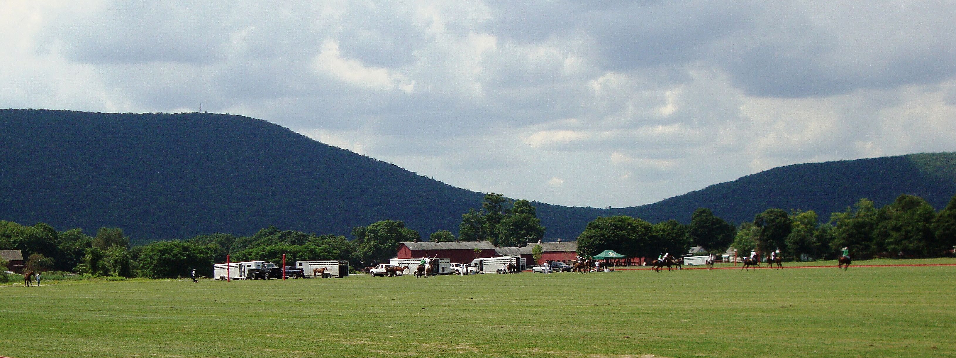
Sand and gravel are abundant resources in the Hudson Valley including Pine Plains, necessary for building roads and for other uses. In the latter half of the 20th century as local farms began to struggle financially, farm owners found that allowing gravel companies to mine their uncultivated land helped them stay afloat. However, it was not without controversy as its environmental impacts became more widely questioned.
Sources and Suggested Further Reading:
History of Columbia County, New York, by Capt. Franklin Ellis, 1878
Natural History of New York, Part 4, Vol. 1, by William M. Mather, Printed by Carroll & Cook, printers to the Assembly, 1843
New York State Historical Markers: It Happened Here: "The Rust Belt of Colonial New York"
How Stuff Works: "How Iron and Steel Work"
Gasoline in the Water
In August 1916 the local newspaper reported that the village water supply tasted of gasoline and "other products," and in fact, the water was condemned by the State Board of Health for drinking purposes. In early September 1916, a barn at the Stissing House burned to the ground; it was said that the gasoline in the water hampered the fire fighter's efforts. Some thought there could be an oil vein running underground through Pine Plains, but the more likely explanation was that the wells were somehow being contaminated from an unnatural source. While this was never solved, it was noted that the wells where the Pine Plains hamlet got its water from when the springs on Stissing Mountain went dry in summer were located south of the hamlet near the railroad station.